

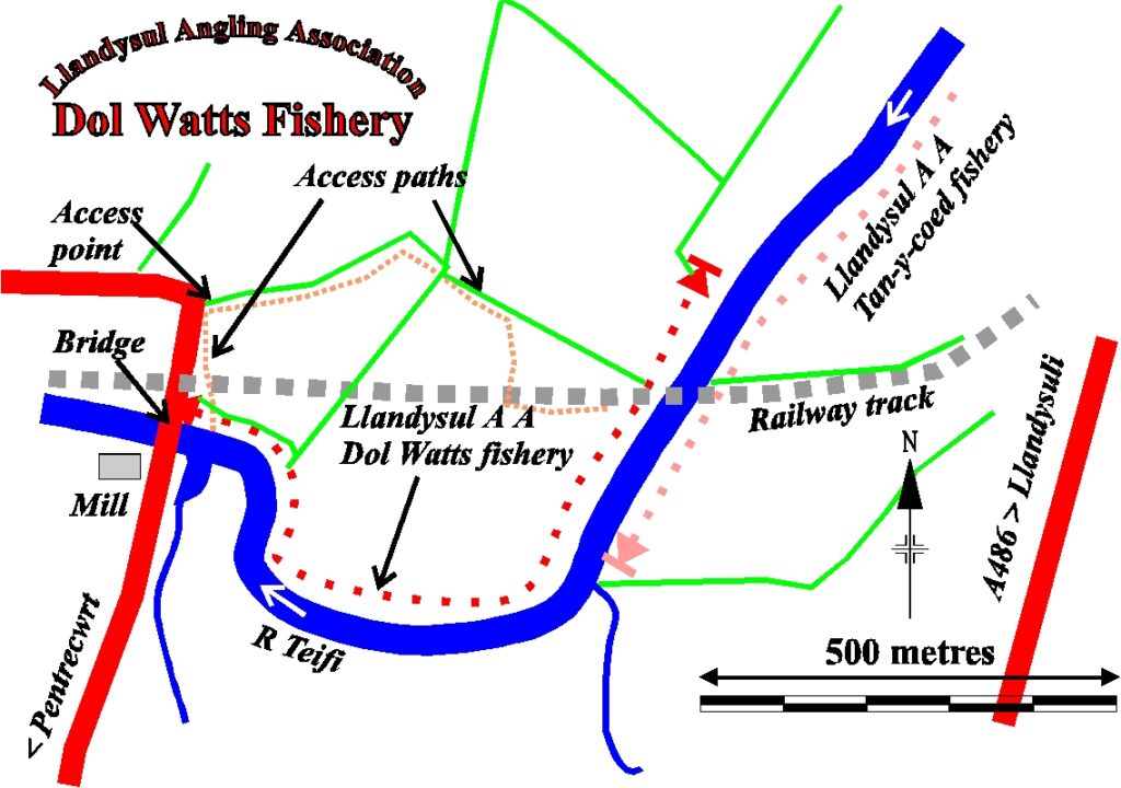
BEAT 14 – DOLWATTS
OVERVIEW
There is a spectacular view from Alltcafan Bridge (the highest bridge over the Teifi) looking upstream along the Dolwatts Beat. The village of Pentrecwrt is just visible when looking upstream, whilst below the bridge you have an old mill and weir, before the river disappears into a fast and narrow gorge.
This is an ideal stretch for anyone who enjoys fly fishing but require a clear back cast. Over most of this beat the bank is low and clear of trees, yet there is still plenty of underwater structure and bushes etc. on the opposite bank to hold the interest of the fish.
The run in to the pool just above the bridge can be very productive for sea trout at dusk, but care should be taken as the wading is tricky at this point over the bedrock.
Fishing from the bank or with wellington boots is possible on the majority of this beat, if required.
BEST FOR
There are some really nice brown trout to be found throughout the beat, especially when targeting them in the evening. However, the beat is definitely best known for its salmon and sea trout (sewin) fishing. A lot of fish can stack up on this beat, especially given that there is a small tributary entering along the beat but also when fish have run through the fast, narrow gorge below, they often like to rest up on this beat.
The main bend in the middle of the meadow is a lovely and safe pool to fish through. You may even fish it safely from the bank if you wish.
ACCESS
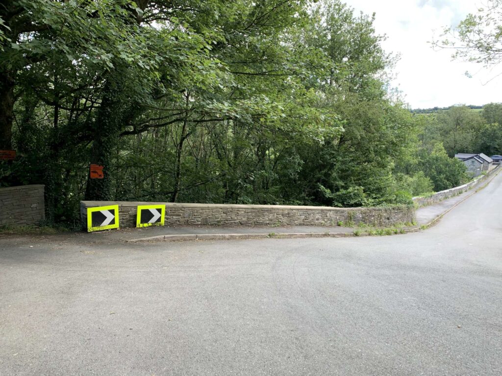
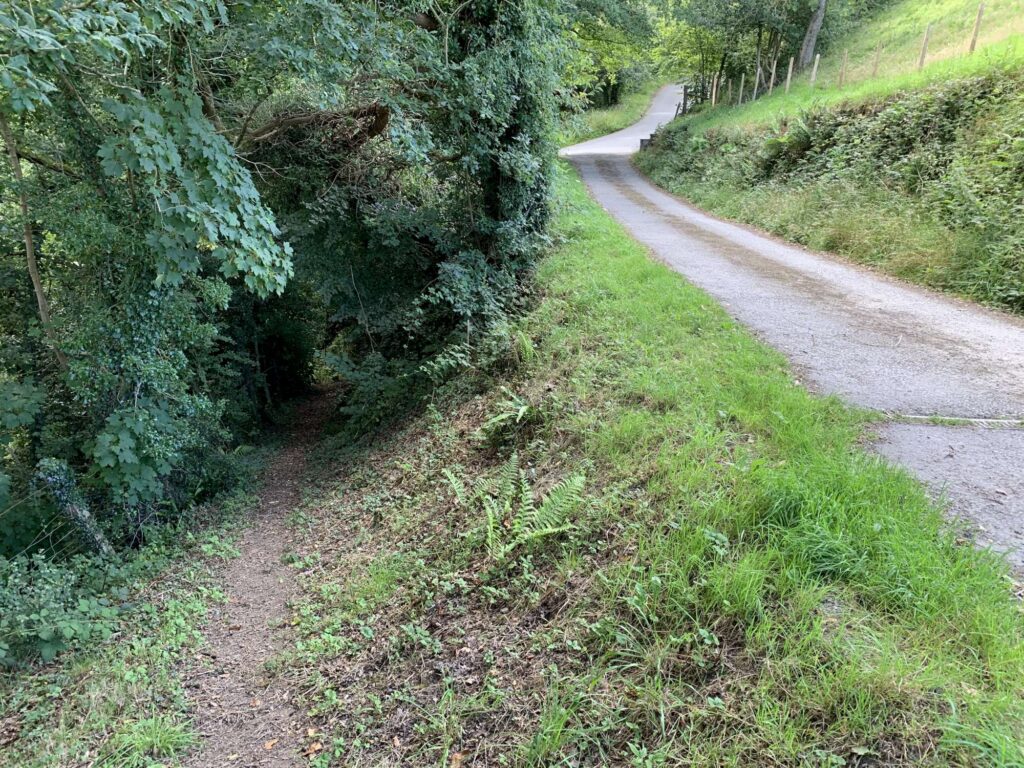
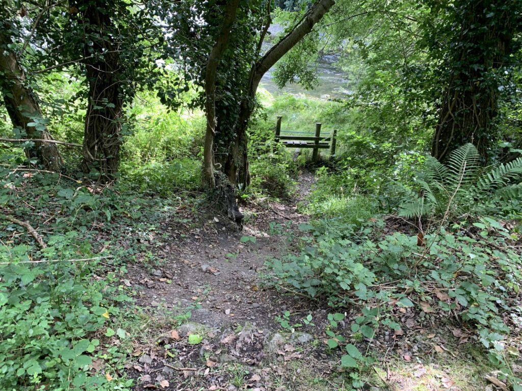
There is parking on Alltcafan Bridge itself. When parked, walk up the hill and you will see a farmtrack leading to the right. Walk down that track for around 15 metres and you will see a path doubling back on yourself, which will take you down onto the beat. Please see the images below for reference. the path does get steep, so please take care.
The beat starts near the remains of an old railway bridge and ends by the road bridge. It is entirely on the right bank. However, if you cross at the tail of the pool where the remains of the old railway bridge are situated, you can access the Tanycoed Beat (13A) on the left bank.
Navigation Pindrop HERE.
Navigation GPS – 52°01’40.4″N 4°21’10.6″W
MAP & AERIAL VIEW
")
")
")