

BEAT 14B – KINGSMEADOW
OVERVIEW
Please note that this beat is fly fishing only when the river level is below the marker, which can be found beside the river when you first enter the beat / field.
This is one of our lowest beats, but also one of our most prolific beats. It has a fantastic mixture of water that suits most levels and also most species. A great all-rounder.
There are three notable and sizeable holding pools, all holding a good head of sea trout (sewin) throughout the year. Between them, there are some other lovely smaller pools, runs and glides that are all worth fishing.
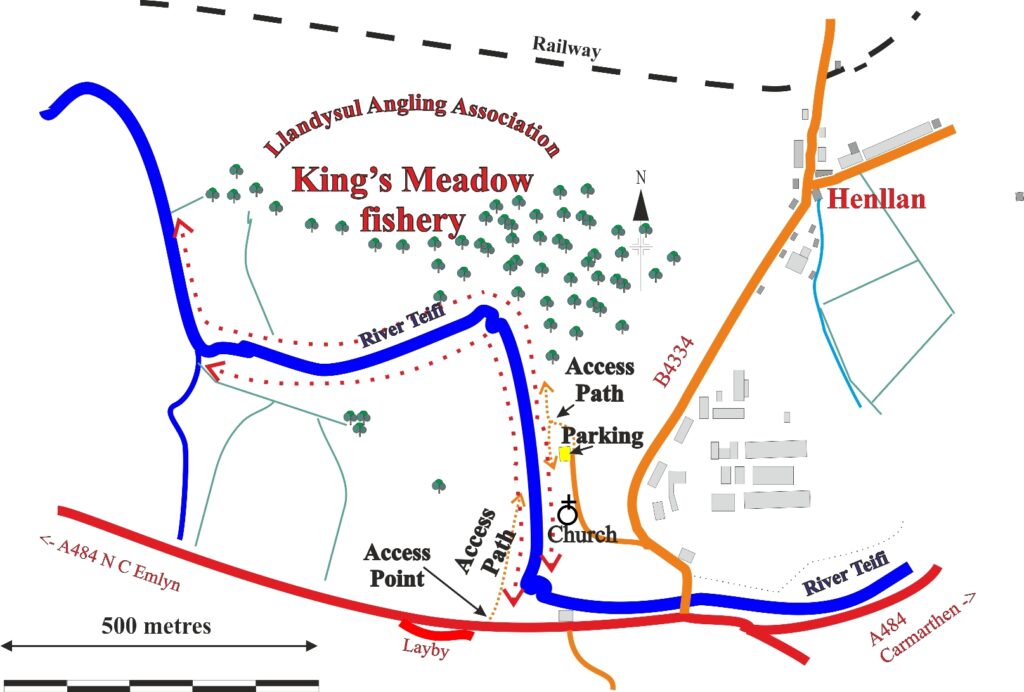
This is a double bank beat, with the left bank starting when you first enter the field and ending where a small tributary enters the main river. On the right bank, the beat starts on the tail end of the big pool below the white house and ends in the field below the junction pool – the hedge line denotes the beat end. The right hand bank is around 200 metres longer than the left bank.
BEST FOR
This is a great mixed fishery, but is definitely a jewel when it comes to salmon and sea trout (sewin) fishing, especially given the numerous and notable holding pools found along the beat. The beat does fish well under all water heights, with spin fishing permissible and scoring well during high water conditions.
There is a good head of trout along the beat and some fantastic sport can be had in the evenings. A few grayling have made an appearance on the beat too.
ACCESS
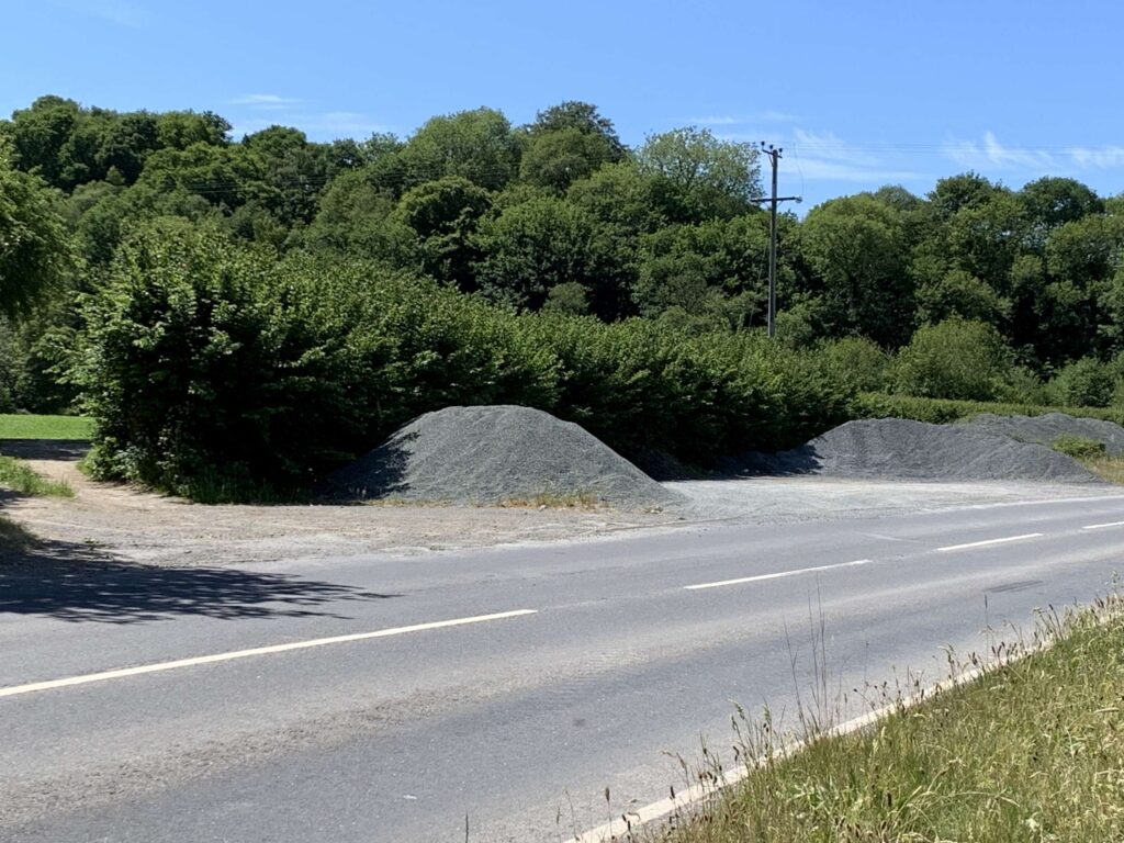
Parking for the left hand bank is in a large layby (image below) alongside the A484, some 200 metres on from the Henllan turning when heading toward Newcastle Emlyn. When parked, walk back up the road for some 20 metres and walk through the gateway on the opposite side of the road – take care when crossing, as it is a fast / busy road. We recommend fishing this bank as a first entry point, before you get to know the beat better.
Around half way down the beat there is a ford, which can be used as a crossing point (with care) when the water is low.
If you would like to fish the right bank, then cross the bridge over the river and take a left hand turn down a small track on the first corner you get to. This will take you down alongside an old Church and there is parking at the end of this track – sufficient parking for two cars.
Navigation Pindrop HERE.
Navigation GPS – 52°02’04.1″N 4°24’11.7″W
MAP & AERIAL VIEW
-2500")
-2500")
-2500")